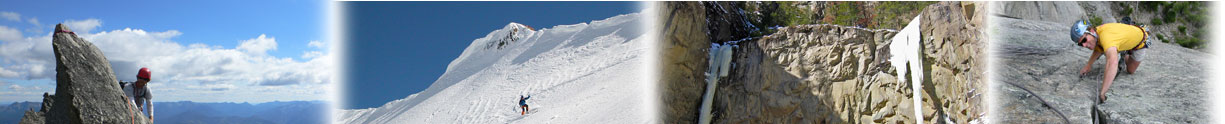
 Wednesday I climbed an ice route on the north side of Mt Rearguard. The route is probably WI 3, with 4 pitches each about 40 meters length, and maybe 3 more 3rd class sections above to reach the plateau. The ice was solid and only a little brittle. In each of the six V-threads I put in to rap off, the ice shavings from the screw were left in the holes and I had to blow the shavings out in order to thread the cord. I've never seen the ice that consistant before.
Approach was up the Lake Fork trail to Black Canyon Lake. The route is less than 1/4 mile beyond Black Canyon Lake and directly left and up. It took 11 hrs car to car solo.
Typical Beartooth question, has it been done before? I called the route "Complete Disrearguard", but if it's been done already, disregard the name completely.
Stan
- Log in to post comments
Looks good Stan.
Looks good Stan.
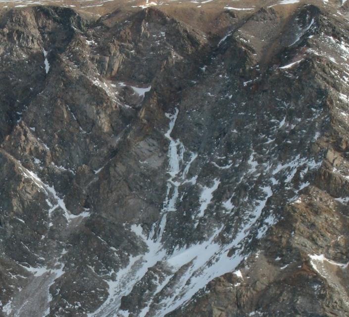
Turiano's "Peaks of the Greater Yellowstone" mentions on page 196 that in 1979, "He (Jim Williams) and Rick Hooven had climbed an ice flow on the southwest side of the beautiful unnamed peak west of the confluence of Lake Fork and Black Canyon Creek."
Looking at a USGS quad the unnamed peak described in the description would be Thunder Mountain, but having been through the canyon a couple of times I have not seen any ice or terrain worthy of an ice flow on its southwest flanks. Due to the looseness of the description and I have often wondered if your ice flow is the one described.
either way, way to get after it!
-Joel
Nice Work!
Hey Stan
Nice Work on the solo mission.
More Ice on Rearguard
We were up at Black Canyon Lake on Presidents Day weekend and climbed the ice line just up the canyon on the same side of Rearguard. After camping at the back end of the lake, we hiked the next big gully up from your Complete Disrearguard line on Sunday morning.
We climbed 3 pitches of probably WI 3 that started out a little thin, but got thicker as the climb went on. The ice ended after the rambling, slightly lower angle third pitch in what looked like a 3rd class boulder scramble to the plateau, which would put you pretty close to the summit of Rearguard. We were able to sling a rock above the third pitch on the left, and then two more v-threads got us the rest of the way down with our 60m twins.
We jokingly started calling the route "Watch Your Cornhole" because we climbed it the day after we had spent Valentines Day evening shivering in close quarters in the tent with four of us dudes at the base of a mountain called Rearguard. We had the same question of whether or not its been done before. I'd be kind of surprised if it hasn't been climbed before, but it would be interesting to hear.
Either way, it was fun moderate ice climbing in a spectacular alpine setting. Great views of Beartooth Mountain and the Bear's Tooth spire. If it hadn't been quite so cold, it would be a great line to the summit of Rearguard.
Nice work on the 11 hour car-to-car push. Very impressive. I'll try to put photos up of our climb if my computer will cooperate.
Traffic in Black Canyon
Phil, way to go on the Rearguard route. By the way, great name for the route. That's why I climb solo, it's the best way to guard your rear.
Two days before I climbed Complete Disrearguard, I had skied up to the base of the Bears Tooth and somehow missed the route you did. Yesterday three of us were attempting the Bears Tooth and two of us were avalanched off the snow slope traversing to the base. After losing over 600 vertical feet, we decided not to go back up. Skiing out I saw the route you did and pondered going back up for it. Oh well, aced out on the ice route and spanked by the Tooth.
As for whether either of our routes have been done, who knows. As for Joel's question about which route Jim Williams & Rick Hooven climbed, the 1st photo is ice above Black Canyon Lake on the south side of Thunder Mt. This photo better fits the discription of their ice climb.